Deliverables/Products
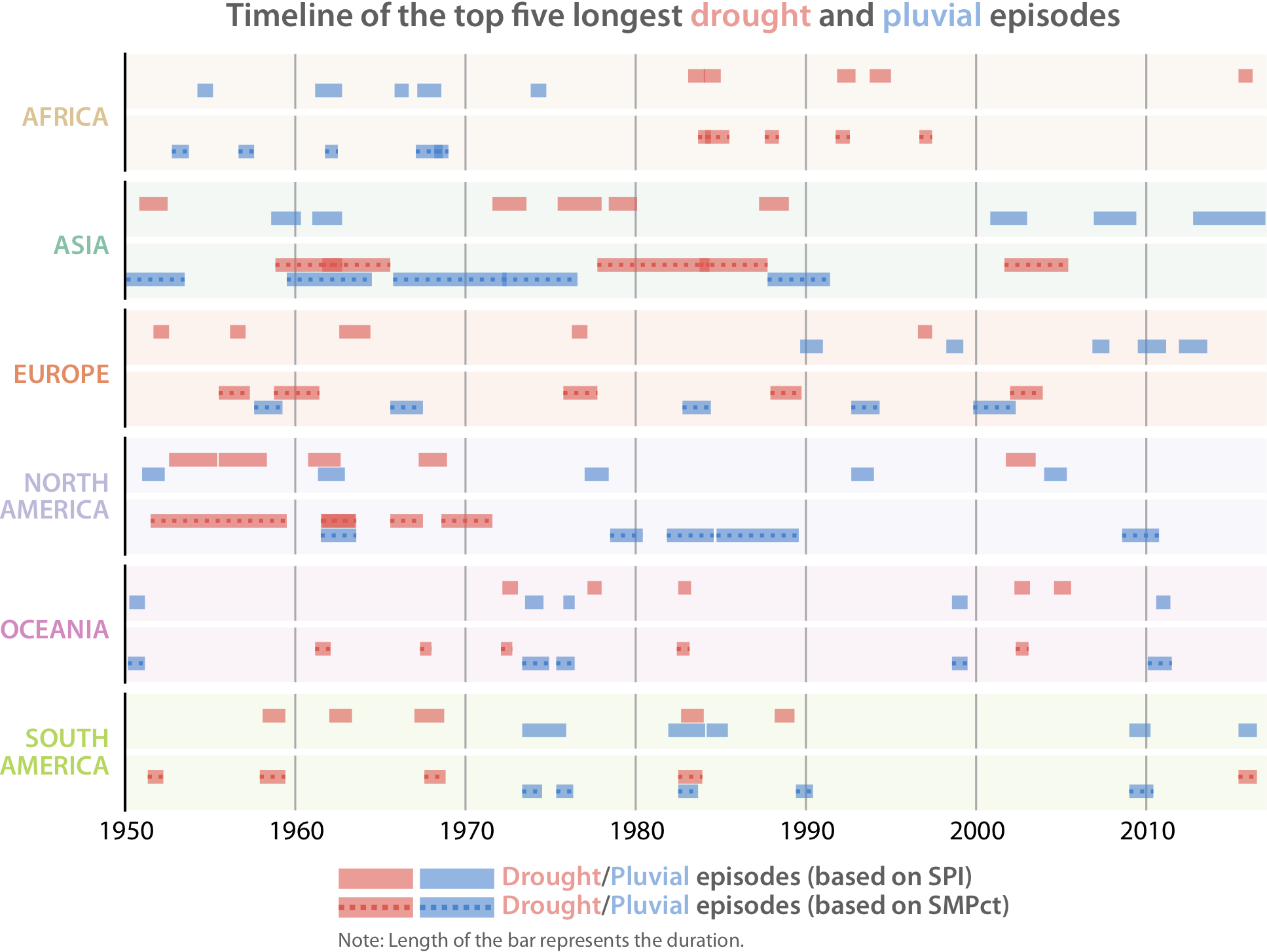
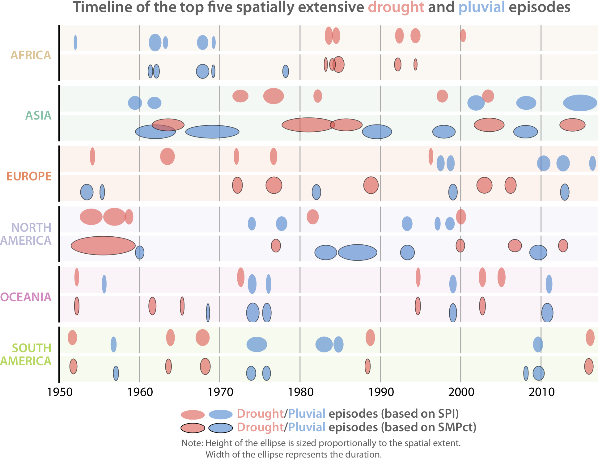
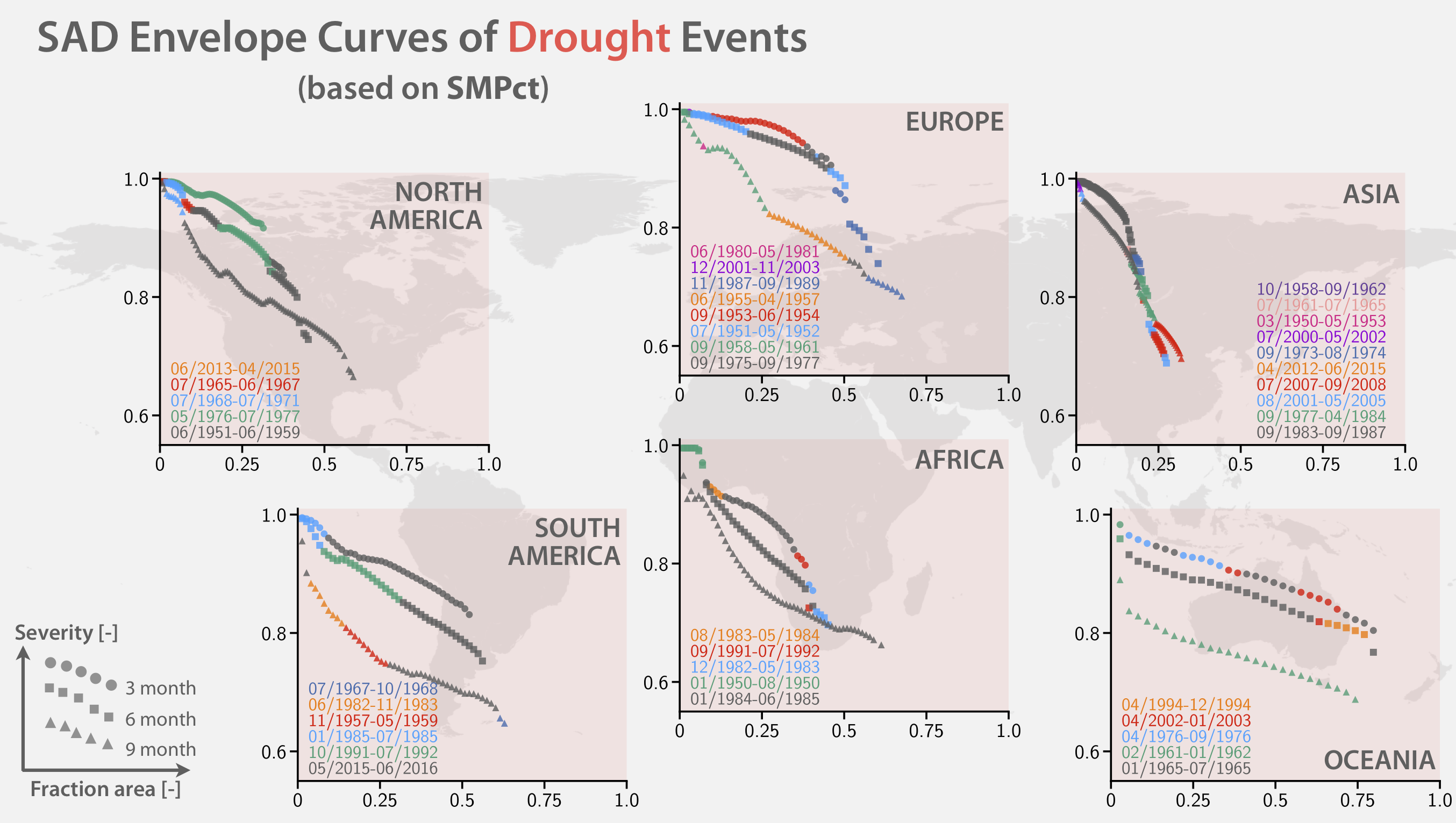
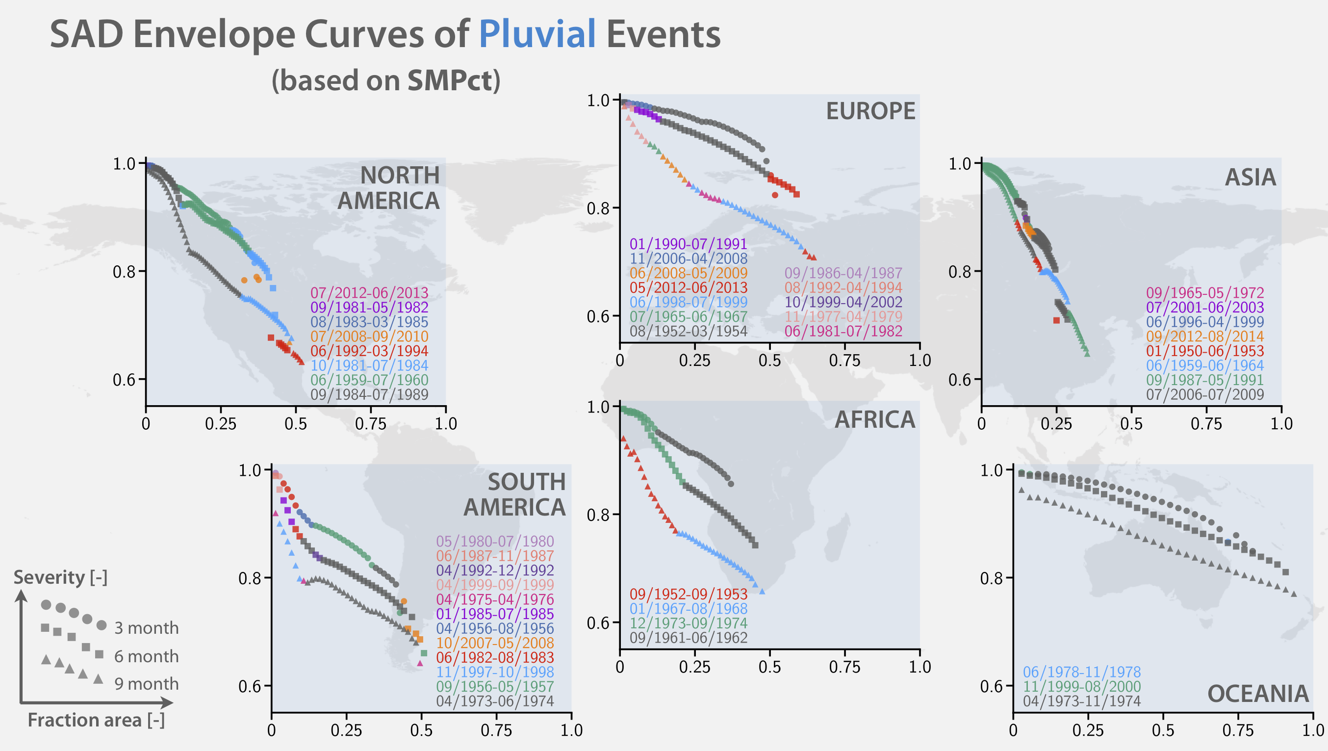
The GDFC delivers relevant products, including continental drought and pluvial catalogues, global-scale drought and flood (pluvial and fluvial) risk maps, long-term meteorological and agricultural standardized indices, underlying meteorological forcings and land surface hydrological fluxes and states [Table 1].
| Products |
Variables/Indices
|
Data source &
Description
|
Attributes
|
Format
|
||||||||||||||||||||||||||||
| Catalogue
|
Drought inventory
(Agricultural & Meteorological)
|
SAD
clustering algorithm
event ID,
| date,
duration,
spatial extent,
severity
(6 continents)
txt, csv
| Pluvial inventory
|
(Agricultural & Meteorological)
Hazard maps
|
|
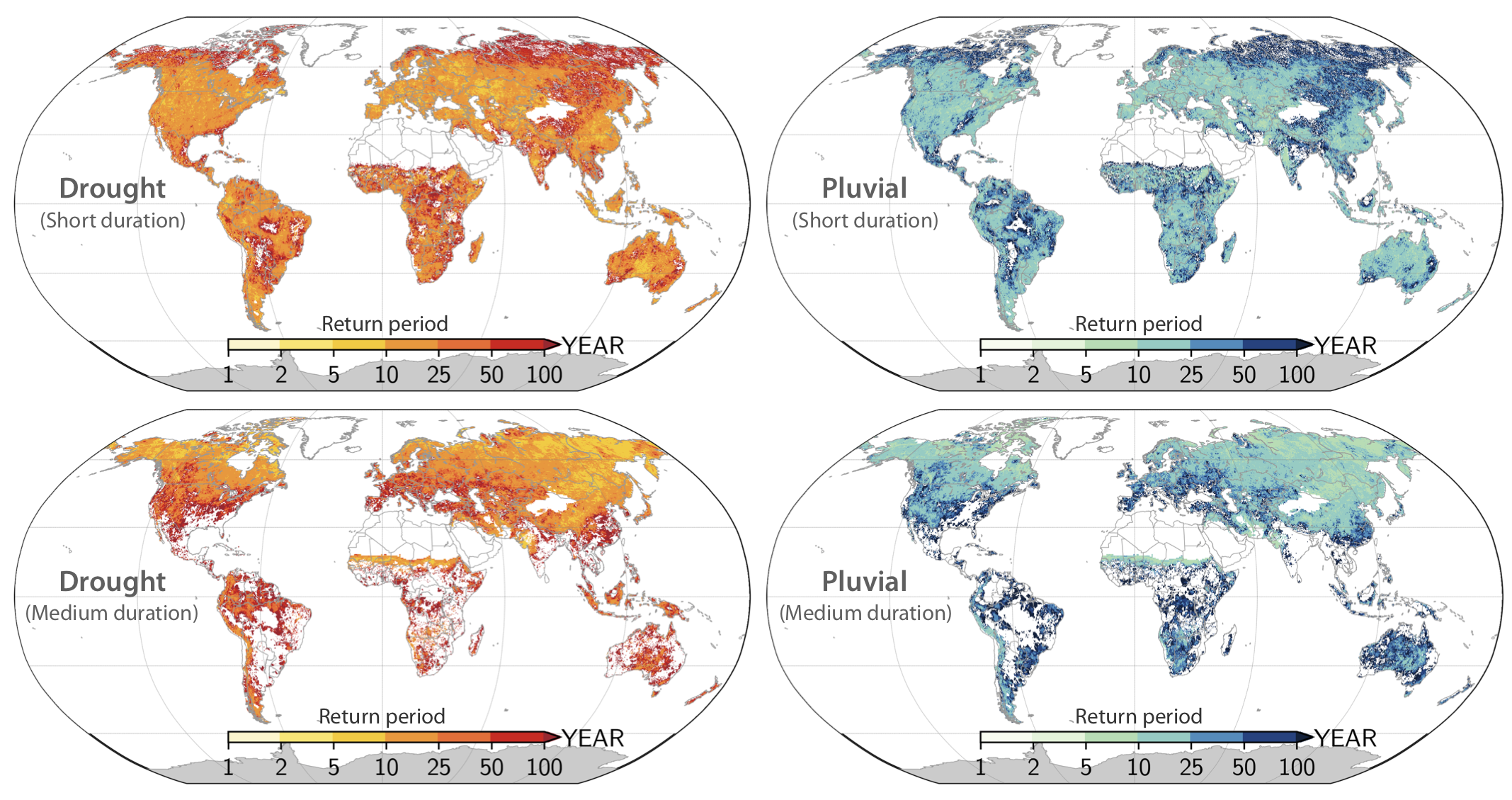
Drought frequency
(Agricultural & Meteorological)
Return period calculated
| from standardized indices
0.25°;
| duration with 1-3,
4-6,
7-12,
> 12 months
netCDF4
| Pluvial frequency
|
(Agricultural & Meteorological)
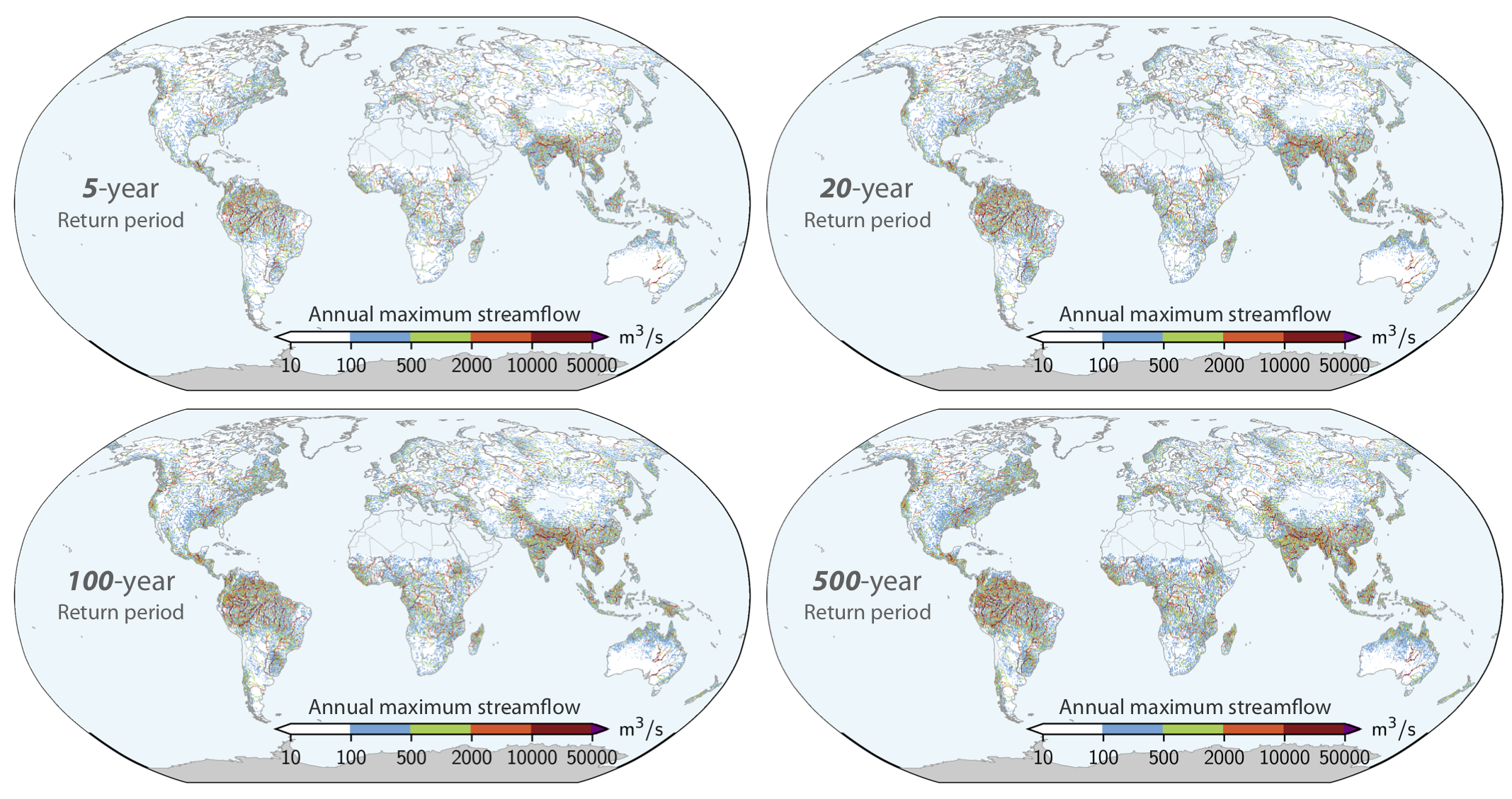
Fluvial risk maps
|
Annual maximum
|
inundation fraction
& daily streamflow
estimated from
CaMa-Flood simulations
and GEV distribution
0.25°;
|
5, 10, 20, 50, 75,
100, 200, 500-year
return periods
Standardized
| indices
|
Standardized Precipitation
Index (SPI)
Precipitation from PGFv3
| (1950-2016)
0.25°;
| SPI1, SPI3,
SPI6, SPI12;
daily,
monthly,
yearly
netCDF4
|
|
Soil moisture percentile
(SMPct)
VIC land surface model
| (1950-2016)
0.25°;
| daily,
monthly,
yearly
Meteorological
| forcings
|
Precipitation,
2m temperature,
Downward shortwave radiation,
Downward longwave radiation,
2m specific humidity,
Surface pressure,
10m wind
|
PGFv3 (1948-2016)
|
0.25°;
3-hourly,
daily,
monthly,
yearly
netCDF4
| Land surface
| hydrological
fluxes & states
|
Evapotranspiration,
Runoff,
Soil moisture (at 0.1 and 1 m),
Streamflow,
Inundation area and fraction
|
VIC LSM and
CaMa-Flood model
(1950-2016)
|
0.25°;
daily,
monthly,
yearly
netCDF4
| |